


Rainfall–runoff and flood routing for any basin on Earth, from a DEM and a storm.
MRRpy, the Multi-Mechanism Runoff and Routing model, is a distributed, physics-based flood model in Python. It traces the drainage network of a DEM, works out how much rain runs off (SCS Curve Number, or Green–Ampt infiltration, saturated source areas (VSA-OPM) and impervious cities in any combination), and routes the water through every grid cell and sub-grid river channel with a kinematic, Muskingum–Cunge or semi-implicit diffusion wave. You get the outlet hydrograph, flood maps and a water-balance check. It runs offline with your own data, or fetches DEMs, NASA IMERG rain, soil and land cover from Google Earth Engine. Set it up in a Jupyter form, a terminal wizard, Python or QGIS; it runs on a CPU or an NVIDIA GPU.
Full docs, guides and API reference → mrrpy.readthedocs.io
Learn the science interactively → the MRRpy course
pip install MRRpy            # core (CPU)
pip install "MRRpy[gpu]"     # + CuPy/CUDA acceleration
pip install "MRRpy[gee]" # + Google Earth Engine forcingfrom MRRpy import Config, run_pipeline
cfg = Config(DEM_PATH="dem.tif", OUTPUT_DIR="results/",
OUTPUT_POINT=(27.632, 85.293), # (lat, lon) of the outlet
TARGET_CRS_EPSG="EPSG:32645") # a projection in metres (UTM zone)
run_pipeline(cfg) # → results/hydrograph.csvOr from the command line:
MRRpy wizard                    # answer a few questions → run.yaml
MRRpy run -c run.yaml           # process_dem + routing
Prefer a form? In Jupyter, MRRpy.ConfigForm() is a step-by-step form like the QGIS
plugin (pip install "MRRpy[notebook]").
Prefer a file? MRRpy init-config -o run.yaml writes a commented template, and
MRRpy explain <SETTING> explains any setting.
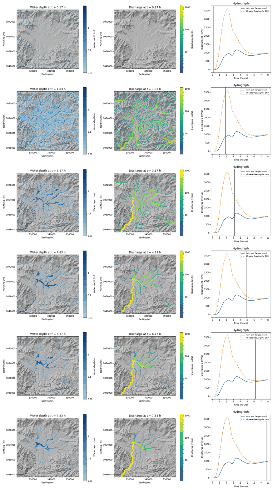
One storm over a whole DEM, animated with MRRpy.animate_fields(out, ["depth", "discharge"]):
water depth, river flow drawn wider where it is larger, and the hydrograph.
- DEM → watershed — reproject, pit-fill, D8 flow direction/accumulation and
delineation (
pyshedsorpyflwdir) — or route the whole DEM with no outlet (MODEL_AREA="whole_dem"). - Flood maps — save depth/discharge maps over time, then animate the flow
spreading (
animate_fields) or export peak-depth GeoTIFFs (export_peak_maps). - Runoff generation —
none · coefficient · raster · scs_cn · physical; forphysical, VSA saturation-excess + Green-Ampt + impervious as composable mechanisms. - Flood routing — kinematic wave, Muskingum–Cunge, or a semi-implicit diffusion wave (backwater, flat valleys, large stable steps), with sub-grid river channels sized from the 2-year flood and an always-on water-balance check.
- Satellite forcing — optional DEM download, IMERG rainfall, GCN250 curve numbers, SERVES soil deficit, SoilGrids, HiHydroSoil, LULC/LCZ via Google Earth Engine (every option also works offline with your own files).
- CPU / GPU — one code path (NumPy or CuPy), automatic CPU fallback.
- Interfaces for every taste — Python API, a
MRRpyCLI with a question-and-answerwizard, a Jupyter form, and a QGIS plugin, all driven by oneConfigobject.
- Documentation: https://mrrpy.readthedocs.io
- Interactive course: https://sauravbhattarai19.github.io/MRRpy/
- Source & issues: https://github.com/SauravBhattarai19/MRRpy
MIT © Saurav Bhattarai.