Tohil - Wildfire intelligence system Named after the Mayan god of fire — symbolizes both the life-giving warmth that sustained ancient civilizations and the destructive force that demands respect. Our platform embraces this duality, creating a digital ecosystem that alerts authorities and guides citizens during wildfire threats, helping communities act swiftly and stay safe.
Stores all wildfire alert events that are shown in the web application. Each document contains telemetry data, classification, map zone, status, and recommendations for citizens and authorities.
Experience Tohil in action through our live demo:
👉 https://tohil-staging.azurewebsites.net/
Explore the real-time wildfire alert dashboard, interactive map, and alert-level system — all in one intuitive interface.
🧠 Best viewed on desktop for full functionality.
| Field | Type | Description |
|---|---|---|
_id |
ObjectId |
Auto-generated by MongoDB |
alertId |
String |
Unique identifier (e.g., ALRT-20250614-032) |
title |
String |
Alert title shown in the UI |
severity |
Number |
Hazard level: 1 (risky conditions) to 4 (confirmed wildfire in urban area) |
sector.id |
String |
Map zone ID (e.g., "C2") |
sector.name |
String |
Optional human-readable name |
sector.polygon |
GeoJSON (Polygon) |
Geospatial shape of the affected zone |
telemetry.temperature |
Number |
In degrees Celsius |
telemetry.humidity |
Number |
Relative humidity in % |
telemetry.windSpeed |
Number |
Wind speed in km/h |
telemetry.windDirection |
String |
Cardinal direction (e.g., "NW") |
telemetry.fuelLoad |
Number |
Dryness index or fire load (0–100) |
telemetry.iotDeviceId |
String |
ID of the originating IoT sensor |
acknowledged.status |
Boolean |
true if verified by authorities |
acknowledged.by |
String |
Name of confirming authority |
acknowledged.at |
Date |
Timestamp of confirmation |
recommendations |
Array[String] |
Instructions for the public |
createdAt |
Date |
Alert generation timestamp |
updatedAt |
Date |
Last modified time |
{
  "alertId": "ALRT-20250614-032",
  "title": "Confirmed Wildfire Near Urban Area",
  "severity": 4,
  "sector": {
    "id": "C2",
    "name": "Sector C2 - North Hills",
    "polygon": {
      "type": "Polygon",
      "coordinates": [[
        [-99.1334, 19.4326],
        [-99.1320, 19.4335],
        [-99.1315, 19.4318],
        [-99.1334, 19.4326]
      ]]
    }
  },
  "telemetry": {
    "temperature": 42,
    "humidity": 10,
    "windSpeed": 33,
    "windDirection": "NW",
    "fuelLoad": 88,
    "iotDeviceId": "iot-00214"
  },
  "acknowledged": {
    "status": true,
    "by": "Fire Dept Zone 3",
    "at": "2025-06-14T21:30:00Z"
  },
  "recommendations": [
    "Evacuate if near forest edge",
    "Avoid outdoor activity"
  ],
  "createdAt": "2025-06-14T21:00:00Z",
  "updatedAt": "2025-06-14T21:30:00Z"
}
Named after Tohil, the revered Mayan god of fire, our platform symbolizes both the immense power and inherent danger fire holds. Tohil harnesses advanced technology to predict wildfire spread, assess risks in near real-time, and recommend optimal emergency responses to safeguard communities and ecosystems.
Wildfires are escalating in frequency, intensity, and scale worldwide, driven by climate change and increasing human activities. In recent years:
- Over 10 million acres burned annually in the United States alone.
- Wildfire damages in California exceeded $20 billion in recent seasons.
- Globally, wildfires contribute significantly to biodiversity loss, pollution, and long-term health issues.
Emergency responders, urban planners, and policymakers urgently need precise, real-time information to mitigate wildfire impacts effectively.
Tohil integrates cutting-edge AI, geospatial analytics, and intuitive visualizations to deliver actionable insights:
- Wildfire Prediction: AI-driven modeling to forecast wildfire spread, intensity, and potential impacts.
- Risk Assessment: Evaluates immediate threats to infrastructure, natural resources, and human communities.
- Resource Allocation & Evacuation Guidance: Recommends optimal deployment of emergency services and efficient evacuation routes.
- Real-Time Telemetry: Harnesses live data from weather stations, IoT sensors, and external APIs to maintain accurate situational awareness.
Backend Technologies:
- Node.js & Express.js power scalable, real-time data processing.
- Azure AI Foundry leverages advanced Large Language Models (LLM) to generate actionable recommendations.
- Azure App Services ensures reliable, scalable, and secure hosting.
Frontend Technologies:
- React.js for interactive and responsive user interfaces.
- HTML, CSS, and JavaScript provide engaging, intuitive visuals.
Our initial demonstration highlights key capabilities:
- Alert Dashboard: An intuitive scrollable event list provides quick access to wildfire alerts, severity ratings, and insightful recommendations.
- Interactive Map: Clearly visualizes hazardous zones with dynamically generated polygons indicating active wildfire areas.
- Telemetry Integration: Real-time environmental and situational data (temperature, wind speed, humidity) displayed alongside actionable advice for citizens and authorities.
By using Tohil, cities and regions can achieve:
- Faster Response: Decrease response times by up to 50%, significantly reducing potential damages and casualties.
- Improved Preparedness: Enhanced prediction and preparedness strategies to safeguard critical infrastructure and human lives.
- Economic Savings: Substantial reduction in wildfire damage costs through better resource allocation and early evacuation strategies.
Leveraging Microsoft's robust ecosystem ensures reliability and scalability:
- Azure AI Foundry: Rapid, advanced analytics using industry-leading AI models.
- Azure App Service: Effortless scalability, security, and global reach.
- Integration & Support: Seamless integration with telemetry data and continuous cloud innovation to keep Tohil ahead.
Tohil adopts Microsoft's Responsible AI practices, emphasizing fairness, transparency, safety, and privacy, ensuring ethical and trustworthy decision-making.
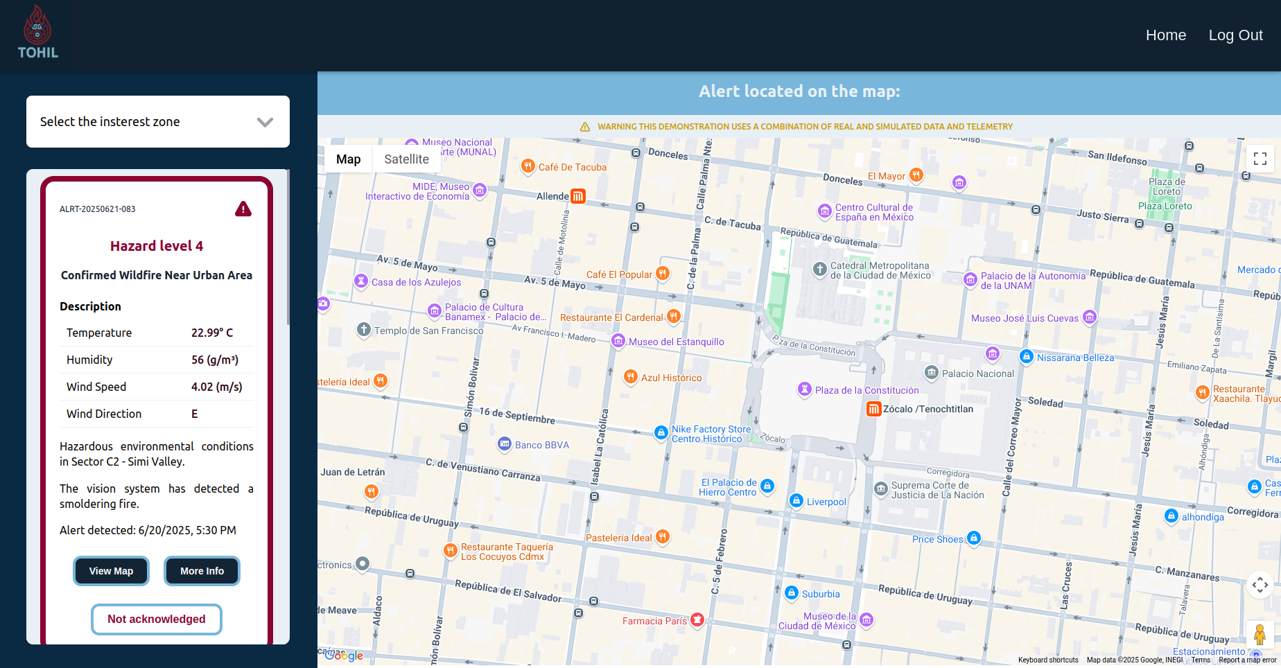
Tohil features a clean, modern, and responsive interface designed to offer fast access to alert information and facilitate decision-making.
The dashboard is the main area where users can:
- View current wildfire alerts.
- Filter alerts by region using the left sidebar.
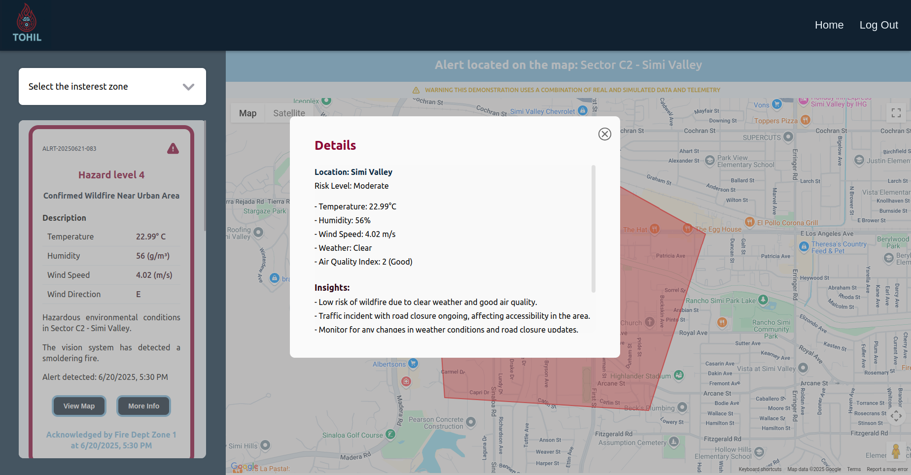
- Interact with alert cards, which include:
- Alert level and description.
View Map: Displays a polygon marking the affected zone on the map.More Info: Shows additional details, safety tips, and insights.- Authority notification status (shows which authority was alerted and when).
On the right side of the dashboard, a real-time interactive map displays:
- Polygons marking affected or at-risk zones.
- Visual context for alerts using geographical data.
Tohil uses a color-coded alert level system:
| Alert Level | Description | Color |
|---|---|---|
| 1 | Favorable fire conditions | Yellow |
| 2 | Possible fire signs (e.g. smoke) | Yellow |
| 3 | Confirmed fire (e.g. visible flames) | Red |
| 4 | High-risk or out-of-control fire | Red |
Screenshots will be provided below to showcase:
- Alert filtering system.
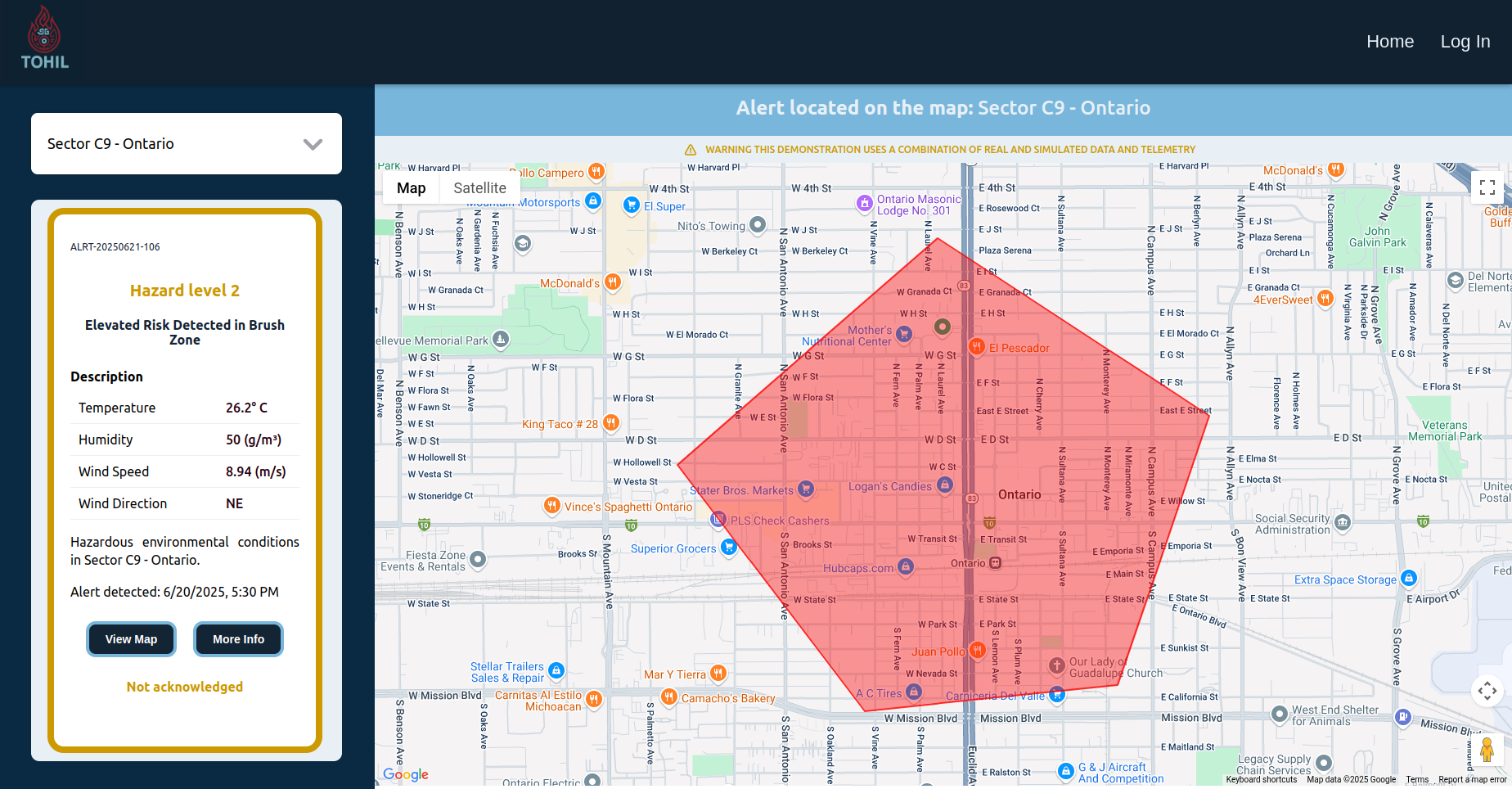
- Interactive map with polygon overlays.
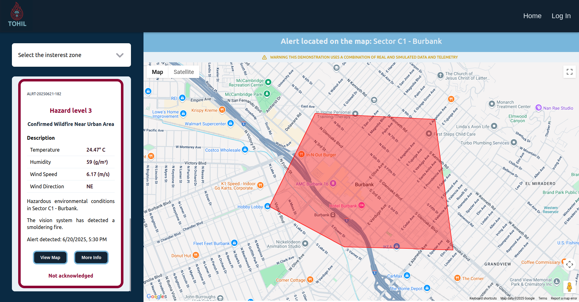
- Alert detail views and authority notifications.
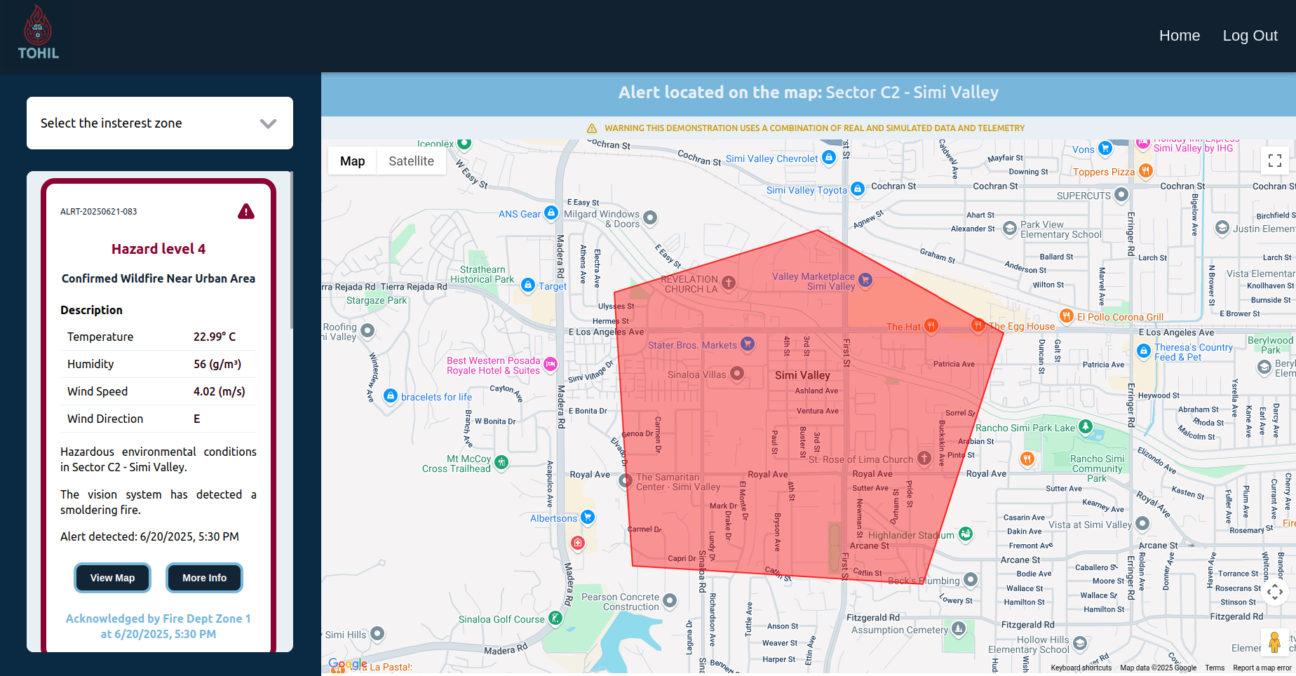
- Alert detail views and authority notifications.
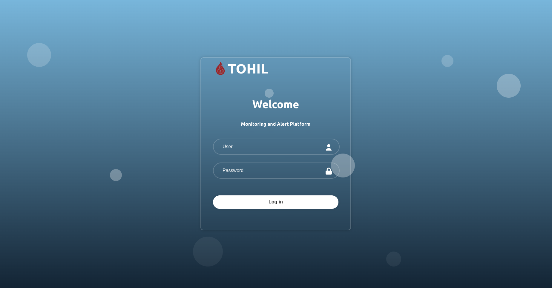
- Authentication login so authorities can mark an alert as acknowledged.
- Home page where the application is explained and how it works.

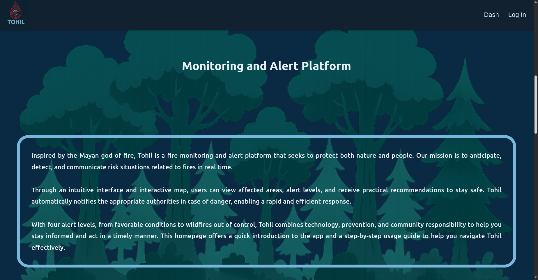
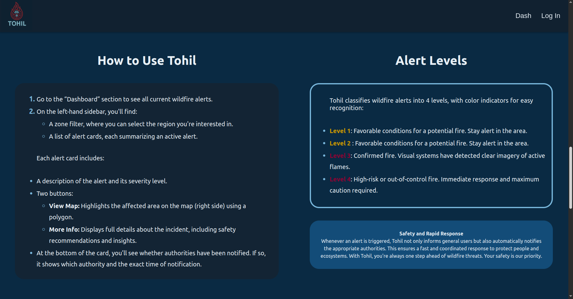
Tohil provides a special feature for authorities to manage wildfire alerts effectively:
- When authorities log in, they have access to an "Acknowledge" button on each alert.
- By clicking this button, authorities confirm that they are aware of the alert and are taking action.
- General users do not have this button; they can only see the acknowledgment status for each alert (whether it has been acknowledged or not).
This feature improves communication and transparency by clearly showing which alerts have been officially recognized by the responsible authorities.
Investors and stakeholders can be part of this pivotal technology transforming wildfire risk management globally.
Together, let's empower communities, save lives, and protect ecosystems from the devastating impacts of wildfires.
🌟 Tohil – Revolutionizing wildfire management, prediction, and response with cutting-edge AI and real-time intelligence. 🌟